

SERVICE
Science and technology lead the future
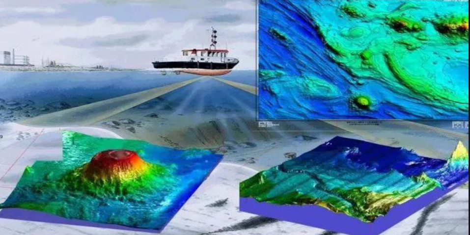
hydrographic surveying and charting
Introduction to the Scope of Marine Surveying and Mapping Services of Haiyi Company:
Main content:
Dock and channel topography survey, submarine geomorphological survey, submarine pipeline survey, submarine cable survey, reservoir capacity measurement, underwater paving detection, underwater structure erosion analysis and underwater geophysical exploration, etc.
Equipment involved:
GNSS receivers, sound velocity meters, tide level meters, single-beam sounder, multi-beam sounder, fiber optic compasses, side-scan sonars, shallow stratigraphic profilers and magnetometers, etc.
Shenzhen Haiyi Petroleum Technology Co., Ltd. has a professional team with marine surveying and mapping qualifications, independently developed high-precision global satellite navigation and positioning system (GNSS), professional QC quality control system and navigation and positioning software for marine surveying and mapping engineering, combined with rich experience in marine surveying and mapping, can complete the comprehensive service of marine engineering surveying and mapping.
 |
 |
Shenzhen Haiyi Oil Technology Co., Ltd
506-507 5/F Shenzhen Research Institute The Chinese University of Hong Kong,No.10, 2nd Yuexing Road, Nanshan, Shenzhen,China
