

PRODUCTS
Science and technology lead the future

NPH40 Beidou high-precision intelligent terminal
With professional GIS acquisition software;Support the import and export of professional desktop software on mobile devices;Multi-source map combination browsing, can support loading vector, grid map, support online map overlay display, and can provide a variety of online maps.

NPY25 Beidou high-precision navigation plate
The software is based on mobile intelligent terminal and integrates Beidou positioning and GIS to meet the requirements of GIS spatial data acquisition in land, forestry, electric power, agriculture, transportation and other industries research and development of information technology construction such as geographic information and mobile interconnection. The software system has features such as multi-source map combination browsing, multi-mode spatial data collection and editing, multi-precision location navigation, multi-thematic map display and cartographic printing, etc. Provide users with integrated mobile GIS solutions.

High-precision positioning and orientation equipment for ship DP system
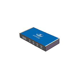
Model: HYPOS®/GNSS NPO20 The HYPOS® Beidou Navigation and Positioning Integrated System is equipped with the HYPOS®10S Beidou high-precision satellite receiver and a complete computer mainframe. It adopts a metal design and incorporates components such as a central processing unit, chip, memory, hardware, graphics card, network card, sound card, two cooling systems, various I/O peripherals, and multiple serial port outputs. It allows for the connection of multiple external displays for simultaneous display. The user operating system is Windows

The HJ-CH4 is a lightweight, highly sensitive gas detector based on Tunable Diode Laser Absorption Spectroscopy (TDLAS) that enables rapid detection of methane at concentrations as low as 5ppm.m from up to 300 meters away. The device cleverly precisely calibrates the detection laser and visible light sensors to achieve accurate laser methane detection and visible light supplemental inspection; Combined with the gimbal intelligent stability control technology, it can quickly provide users with key information, help users seize opportunities, and improve perception and operational efficiency to a new level.

Fully automatic methane detector
The HJ-CH4 mini fully automatic airport drone methane detection sensor is an advanced TDLAS laser detection technology designed to detect and map methane (CH4) concentrations with high accuracy. The system integrates seamlessly with DJI Dock 2 and is highly compatible with matrice 3D/3TD, which greatly reduces costs and improves the efficiency of unmanned detection of leaks in industrial sites and pipelines, especially for large-area chemical parks and pipeline inspections, opening up endless possibilities.

GN150(7") Multi-mode Satellite Positioning Navigator
The GN150 series shipborne multi-system radio navigation receiver is a device that supports high-precision Beidou and GPS dual-mode positioning. The sizes include 7 inches, 8 inches, 10 inches, 12.1 inches, 15 inches, and 17 inches. The GN150 series has passed the CCS type approval of the China Classification Society and supports multi-chart system switching display and multi-language menu display. It can access RTCM 2.3 DGPS signals and has functions such as power failure alarm.

HYPOS® RTK measuring instrument
A mini portable multi-function GNSS receiver that supports tilt measurement, built-in 4G full network access, Bluetooth, WIFI and 5W data transmission radio, adopts a sturdy and lightweight magnesium alloy structure, and Linux operating system. It is an extremely lightweight, full-featured and portable geodetic GNSS receiver.

The HYPOS®-5700A model is a multifunctional design that utilizes only a few effective communication conditions of ships. Combined with actual distress scenarios, it can enable crew members to communicate and alarm in a timely manner, detect and rescue in a timely manner, save lives, and reduce losses after falling into water. It is an effective product that effectively solves the problem of falling into water and obtains rescue. It has been certified by the CCS system
Quality control system is a quality monitoring system with high precision, real-time optimization, and multimode combination.
Shenzhen Haiyi Oil Technology Co., Ltd
506-507 5/F Shenzhen Research Institute The Chinese University of Hong Kong,No.10, 2nd Yuexing Road, Nanshan, Shenzhen,China
