
HYPOS®BeiDou high-precision satellite receiver
零售价
市场价
Category:
Own Products
重量
kg
库存
隐藏域元素占位
- DESCRIPTION
-
HYPOS® BeiDou high-precision satellite receiver
 Support satellite enhanced system, support B2bPPP high-precision positioning Fully compatible with Beidou 3, GPS, GLONASS and GALILEO systems; Support dual antenna lateral, real-time heading data output
Some performance parameters

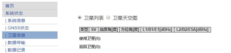
WEB MANAGEMENT INTERFACE

Satellite distribution map and satellite list
 Key words:
- hypos
- satellite
- high-precision
- beidou
- glonass
- protection
- interface
- distribution
previous page
Dear customer, if you have any opinions or suggestions regarding our products or services, please let us know in a timely manner and we will provide you with satisfaction as soon as possible
Related products

NPH40 Beidou high-precision intelligent terminal
With professional GIS acquisition software;Support the import and export of professional desktop software on mobile devices;Multi-source map combination browsing, can support loading vector, grid map, support online map overlay display, and can provide a variety of online maps.

NPY25 Beidou high-precision navigation plate
The software is based on mobile intelligent terminal and integrates Beidou positioning and GIS to meet the requirements of GIS spatial data acquisition in land, forestry, electric power, agriculture, transportation and other industries research and development of information technology construction such as geographic information and mobile interconnection. The software system has features such as multi-source map combination browsing, multi-mode spatial data collection and editing, multi-precision location navigation, multi-thematic map display and cartographic printing, etc. Provide users with integrated mobile GIS solutions.

High-precision positioning and orientation equipment for ship DP system
Model: HYPOS®/GNSS NPO20 The HYPOS® Beidou Navigation and Positioning Integrated System is equipped with the HYPOS®10S Beidou high-precision satellite receiver and a complete computer mainframe. It adopts a metal design and incorporates components such as a central processing unit, chip, memory, hardware, graphics card, network card, sound card, two cooling systems, various I/O peripherals, and multiple serial port outputs. It allows for the connection of multiple external displays for simultaneous display. The user operating system is Windows

The HJ-CH4 is a lightweight, highly sensitive gas detector based on Tunable Diode Laser Absorption Spectroscopy (TDLAS) that enables rapid detection of methane at concentrations as low as 5ppm.m from up to 300 meters away. The device cleverly precisely calibrates the detection laser and visible light sensors to achieve accurate laser methane detection and visible light supplemental inspection; Combined with the gimbal intelligent stability control technology, it can quickly provide users with key information, help users seize opportunities, and improve perception and operational efficiency to a new level.
Shenzhen Haiyi Oil Technology Co., Ltd
506-507 5/F Shenzhen Research Institute The Chinese University of Hong Kong,No.10, 2nd Yuexing Road, Nanshan, Shenzhen,China
